 Martian Alpha
 Satellite Constellations: What Investors Should Track
The 2025-2026 satellite deployment surge, debris and licensing rules, and the signals investors should track: launch cadence, ISL capacity, disposal.
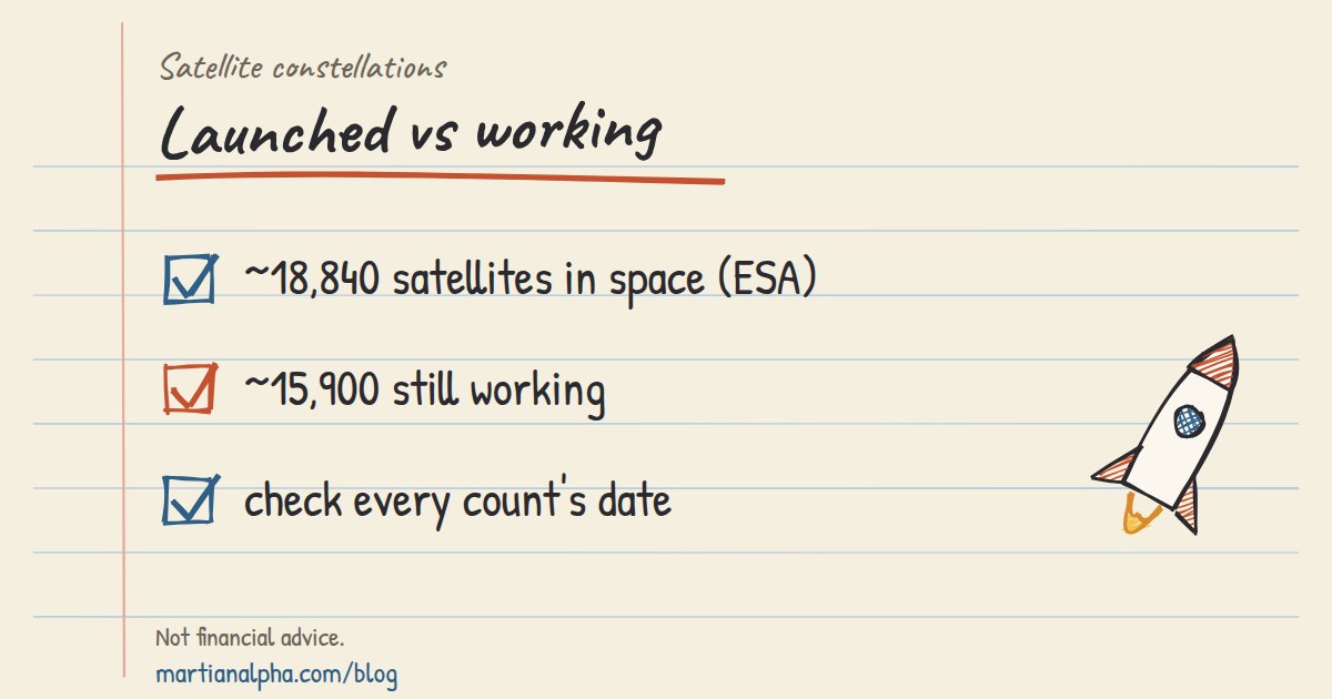
A satellite constellation is a coordinated group of satellites, typically identical in design, working together under shared control to deliver continuous global or regional coverage. The model matters because a single satellite can never watch the whole planet at once, while a properly phased network can. ESA's space debris statistics (last updated July 31, 2026) count about 46,930 objects regularly tracked by space surveillance networks, and about 18,840 satellites still in space, of which about 15,900 are still functioning (ESA DISCOSweb statistics). Specialized tools track a growing share of that traffic for investors watching the sector.
TL;DR:
- Nearly a quarter of active payloads now operate below 500 kilometers, as atmospheric drag accelerates satellite disposal and necessitates frequent replenishment launches.
- The move toward multi-shell and layered constellation designs enhances coverage and resilience, but inter-satellite link capability remains a bottleneck for overall network throughput.
- Regulatory commitments now include collision-avoidance automation and disposal timelines, with stricter standards increasingly enforced to mitigate space debris risks.
- Deployment in 2025 saw over 4,000 new satellites launched, with operators concentrating more assets in lower altitudes to maintain coverage through rapid replenishment.
- Investors should monitor launch cadence, authorization trends, and ISL hardware capabilities, as these signals better predict constellation sustainability than satellite counts alone.
What Is a Satellite Constellation, and How Did It Become the Default Design?#
Satellite communication constellations were not always the standard. Through the 1990s and 2000s, most operational fleets consisted of a handful of large, expensive geostationary satellites, each doing the work of an entire regional network. That model made sense when launch costs were high and electronics were bulky. It broke down once miniaturized components, reusable rockets, and mass-manufacturing techniques made it cheaper to build hundreds of small satellites than to build one exquisite one.
The technical essence of a constellation is coordination, not just quantity. Engineers place satellites into specific orbital planes with defined spacing, so that as one satellite drops below the horizon for a ground user, another rises to take over. Inter-satellite links (ISLs) increasingly connect these planes into a mesh, letting data hop between satellites before touching the ground. That shift toward networked, self-routing fleets is what separates a modern constellation from a loose cluster of satellites sharing an orbit.
Three stakeholder groups drive most constellation activity today:
- Commercial operators building broadband, IoT, and imaging fleets for paying customers.
- National space agencies deploying navigation, weather, and defense-related constellations.
- International science bodies coordinating spectrum use and monitoring the environmental impact of rapid deployment.
Each group has different incentives, and those differences show up directly in how a constellation is designed.
LEO, MEO, or GEO: Which Orbit Fits Which Job?#
Altitude is destiny for a constellation. It sets the trade-off between coverage per satellite, latency, and how many spacecraft you need to keep the lights on. Low Earth orbit satellites, generally flying between 300 and 2,000 kilometers, deliver low latency and cheap launches per unit, but a single satellite covers a small patch of ground and burns through its orbit fast. Medium Earth orbit sits in the 2,000 to 35,786 kilometer band and is the traditional home of GNSS constellations like GPS and Galileo, trading some latency for far larger coverage footprints and longer operational life. Geostationary orbit, fixed at 35,786 kilometers, needs only three well-placed satellites for near-global coverage but carries the highest latency of the three.
| Orbit class | Typical altitude | Latency | Satellites needed for global coverage | Typical lifetime |
|---|---|---|---|---|
| LEO | 300–2,000 km | 20–40 ms | Hundreds to thousands | 3–7 years |
| MEO | 2,000–35,786 km | 60–140 ms | 20–30 | 10–15 years |
| GEO | 35,786 km | 240+ ms | 3 | 15+ years |
The clearest recent trend is the move toward sub-500 km operations. Operators now deliberately fly roughly a quarter of active payloads below 500 kilometers specifically because atmospheric drag pulls dead satellites down faster there, simplifying disposal. The trade is a shorter operational lifespan and a constant need for replenishment launches, which is exactly why launch cadence has become a metric worth watching in its own right, not just a footnote.
How Are Constellations Designed and Networked?#
Most large constellations still start from a Walker pattern, a geometric method for distributing satellites across evenly spaced orbital planes so that coverage gaps close predictably as the satellites move. Walker constellations are mathematically elegant and easy to model, which is why GNSS systems have used variations of the pattern for decades. Newer commercial broadband fleets are moving beyond a single Walker shell toward multi-shell constellations, layering several altitude bands and inclinations to balance coverage density with collision risk and disposal timelines.
Inter-satellite links are what turn a shell of satellites into a functioning network rather than a collection of independent nodes. Laser-based ISLs now carry meaningful traffic volume in the largest pLEO fleets, and MIT Lincoln Laboratory's research on satellite networking identifies ISL capability as the real throughput and resilience bottleneck for these systems. Each satellite carries a limited number of laser terminals, and that hardware constraint directly caps how many neighbors it can talk to, which in turn limits routing flexibility across the whole mesh.
Design priorities for a modern constellation include:
- Phasing, so satellites hand off coverage smoothly as they cross the sky.
- Redundancy, building in spare capacity so single failures don't create coverage holes.
- Replenishment cadence, planning launches to replace decaying or failing satellites before gaps appear.
- Automated collision avoidance, since manual maneuver planning cannot scale to thousands of satellites.
Pro Tip: When evaluating a constellation operator, check how many ISL terminals each satellite carries relative to competitors. A satellite with more optical terminals can support a denser mesh and route around congestion or failures, which matters more for long-term network resilience than raw satellite count.
Which Applications Actually Benefit From a Constellation Design?#
Not every mission needs hundreds of satellites, but several categories are transformed by the model. Communications and broadband constellations use large LEO fleets specifically to cut latency below what GEO can offer, making real-time applications like gaming and video calls viable from anywhere on Earth. Navigation and timing systems rely on MEO constellations because GNSS accuracy depends on consistent geometric coverage from a stable, long-lived fleet rather than raw satellite density.
Earth observation is where constellation design shows its clearest payoff. A single optical or synthetic aperture radar (SAR) satellite might revisit a location once a week; a well-designed LEO constellation can cut that to hours, which matters enormously for disaster response and agricultural monitoring. Other high-value use cases include:
- IoT and asset tracking, where small, low-cost LEO satellites relay sparse data cheaply.
- Disaster response, where rapid-revisit imaging constellations help direct emergency resources.
- Weather monitoring, blending GEO's constant regional watch with LEO's finer resolution.
- Defense and ISR, where distributed constellations reduce the risk of losing coverage to a single satellite failure or attack.
Each use case pulls the orbit and design decision in a slightly different direction, which is why no single constellation architecture serves every mission equally well.
How Serious Is the Space Debris Problem for Constellations?#
The debris picture is the single biggest constraint on how big and how fast constellations can grow. Current models estimate about 1.5 million objects between 1 and 10 centimeters, and roughly 230 million between 1 millimeter and 1 centimeter, alongside the roughly 46,930 objects regularly tracked by space surveillance networks (ESA, July 2026). Even a millimeter-scale fragment traveling at orbital velocity can disable a satellite, and none of that smaller debris is reliably trackable with current sensors.
The risk compounds because uncoordinated megaconstellation growth pushes more active satellites and debris into the same crowded altitude bands, and ESA now describes debris and active satellite density as comparable in some LEO shells, a dynamic that raises the odds of a runaway collision cascade often referred to as Kessler syndrome. Mitigation practices have tightened in direct response:
- ESA's updated 2026 policy cuts the acceptable post-mission disposal window in LEO to 5 years, down from the older 25-year guideline, and requires a disposal success probability above 90%.
- Design-for-demise practices aim to ensure a satellite burns up completely on reentry rather than leaving surviving fragments.
- Operators are expected to plan adequate separation between orbital planes to reduce conjunction risk from the outset, per UNOOSA's 2025 mitigation guidance.
These aren't abstract sustainability gestures. They're becoming hard preconditions for getting a constellation licensed at all.
How Do Regulators and Astronomers View Megaconstellation Growth?#
Licensing a large constellation now involves more than spectrum allocation. Regulators increasingly tie approval to concrete mitigation commitments, including automated collision-avoidance capability, spectrum-sharing plans, and the disposal probability targets described above. The pattern shows up in real cases, including FCC scrutiny of Gen2 satellite authorizations, where partial grants reflect ongoing negotiation over exactly these conditions.
Astronomy has become a parallel pressure point. Ground-based optical and radio observatories report growing interference from bright, reflective satellite trails and radio-frequency noise, prompting the International Astronomical Union and allied observatories to push for mitigation measures such as darkening coatings and orbit-timing adjustments around sensitive observation windows. Key regulatory themes now shaping approvals include:
- Spectrum coordination agreements to prevent interference between competing constellations.
- Mandatory collision-avoidance automation as a licensing precondition.
- Disposal probability and timeline commitments enforced through national licensing bodies.
- Ongoing negotiation between operators and astronomy organizations over brightness and radio-noise mitigation.
International guidance from UNOOSA and coordination frameworks tied to the ITU are shaping a global baseline, even though enforcement still runs through individual national regulators.
What Does the 2025–2026 Deployment Surge Look Like?#
The pace of deployment over the past year has been extraordinary by any historical measure. In 2025 alone, more than 300 launches placed over 4,000 new payloads into orbit, according to ESA's Space Environment Report. That volume reflects both falling launch costs and the sheer scale of active megaconstellation buildouts, including Gen2 authorizations covering up to 15,000 satellites for a single operator.
This surge is reshaping orbital altitude distribution in real time. Operators are concentrating more of their fleets below 500 kilometers, favoring faster natural decay over longer operational life, which means constellations now churn through satellites faster and rely more heavily on continuous replenishment launches to maintain coverage. ISL-driven network architecture is also maturing alongside this growth, with newer fleets treating optical inter-satellite links as core infrastructure rather than an experimental add-on.
For anyone tracking the sector financially, this cadence is itself a signal. A sudden jump or slowdown in launch frequency tends to precede shifts in constellation operators' revenue timelines, and specialized launch calendar tools are designed to surface such metrics.
What Should Investors and Operators Track in a Constellation Program?#
Assessing a constellation program means watching a specific set of signals rather than raw satellite counts. Authorization volume, launch cadence, ISL capability, and disposal probability commitments each say something different about how a program will perform and survive regulatory review. Altitude band concentration matters too, since a fleet clustered in a single crowded shell carries more collision exposure than one spread across multiple altitudes.
A working due-diligence checklist should cover licensing conditions, the operator's replenishment model, stated resilience measures, and transparency around collision-avoidance systems. Dedicated platforms consolidate these signals into a single view, which matters when the underlying data changes weekly rather than annually.
How Did Satellite Constellations Evolve Into Today's Megafleets?#
The earliest satellite networks were built for redundancy, not coverage density. The Soviet Molniya system, launched starting in 1965, used a handful of highly elliptical orbits to serve high-latitude regions that geostationary satellites couldn't reach well. GPS, developed through the 1970s and fully operational by the 1990s, proved that a coordinated MEO constellation of roughly 24 satellites could deliver a genuinely global navigation service, setting the template other GNSS systems later followed.
The real inflection point came with Iridium in the late 1990s. It was the first large commercial LEO constellation, built around 66 satellites with inter-satellite links designed to route voice calls across the network without needing a ground station in range. Iridium was a commercial disappointment at launch, but its technical architecture, especially the ISL mesh, anticipated exactly the design pattern that dominates the industry today.
The 2010s brought the miniaturization wave that made truly massive constellations financially viable. CubeSats and small-satellite manufacturing techniques slashed the cost per unit, while reusable launch vehicles slashed the cost per launch. Those two trends together are why a modern broadband constellation can justify building thousands of satellites where Iridium struggled to justify dozens. The current generation of megaconstellations, several thousand satellites strong, is really the compounding result of four decades of orbital mechanics knowledge meeting a decade of manufacturing and launch cost collapse.
What Technical Problems Still Complicate Deployment and Maintenance?#
Collision avoidance is the most persistent operational headache at megaconstellation scale. With tens of thousands of active payloads and far more tracked debris fragments sharing crowded LEO shells, manual conjunction-assessment processes simply cannot keep pace. Automated maneuver systems are becoming standard, but they introduce their own risk: a false-positive maneuver can burn scarce propellant, and propellant is one of the hardest constraints on a small satellite's operational lifetime.
Propulsion limitations shape almost every other design decision. Small satellites carry limited fuel budgets, which caps how many collision-avoidance maneuvers a satellite can perform before it can no longer maintain its orbital slot or execute a controlled deorbit. That constraint is part of why lower operating altitudes, where drag handles disposal passively, have become so attractive despite the shorter lifespan they impose.
Ground infrastructure adds a less visible but equally real bottleneck. Every constellation needs enough ground stations, or enough ISL capacity to route around sparse ground coverage, to actually deliver the latency and throughput it promises. Building that infrastructure at a pace that matches launch cadence has proven harder for some operators than building the satellites themselves. Spectrum interference between competing constellations occupying similar frequency bands is another recurring friction point, one that regulators are increasingly forcing operators to resolve through coordination agreements before launch rather than after.
What Comes Next: Optical Links, AI, and Smarter Networks#
Optical inter-satellite communication is moving from experimental to standard equipment across major constellations. Laser links carry far more data than radio-frequency ISLs and are harder to intercept, and research into next-generation laser terminal design is focused squarely on shrinking terminal size and power draw so more satellites can carry more links without blowing their mass and power budgets.
Artificial intelligence is starting to take over tasks that used to require ground-based human judgment. Onboard AI is increasingly handling routing decisions across ISL meshes, flagging potential conjunctions faster than ground-based systems can process them, and prioritizing which imagery or sensor data is worth downlinking immediately versus queuing for later. MIT Lincoln Laboratory's networking research points toward a hybrid model, where ground systems calculate optimal routing paths on a schedule while onboard systems handle simple backup routing when conditions change faster than ground updates can reach the satellite.
The next architectural shift is deeper integration between space-based and terrestrial 5G and 6G networks, treating a constellation less as a standalone service and more as one layer in a unified connectivity stack. That integration, combined with multi-shell designs spanning several altitude bands, suggests future constellations will look less like a single geometric pattern and more like a layered system optimized separately for coverage, resilience, and latency at each level.
Author Perspective: Megaconstellations Are Transformative, but Coordination Is Lagging#
Megaconstellations genuinely unlock services that weren't previously possible: real-time global broadband, hourly Earth imaging, resilient defense communications. That much is not in dispute. What concerns me is the gap between the pace of deployment and the pace of coordination. ESA's own reporting on comparable debris and satellite density in crowded LEO shells should be a louder alarm than it currently is.
The fix isn't slowing innovation. Watch how fast automated collision avoidance systems mature over the next two years. That will tell you more about the sector's sustainability than launch counts ever will.
Track Constellation Data With Martian Alpha's Research Terminal#
Following the technical and regulatory signals covered here, from disposal probability commitments to launch cadence, gets hard fast when the data changes weekly and lives across a dozen scattered agency reports. Some research terminals are built specifically for space industry investors and analysts, pairing constellation tracking with launch calendars, automated alerts, and AI-powered company analysis so users can watch authorization volume, launch frequency, and operator disposal commitments without hunting across sources.
Every core research tool on Martian Alpha stays free, including baseline constellation tracking and launch scheduling. Readers who want deeper datasets and power-user tools can upgrade; the plans page lists what each tier adds. If you're weighing exposure to a specific constellation operator or want to see how launch cadence is trending this quarter, start with the free tier and see what the terminal surfaces.
Authoritative Reports and Primary Sources#
- ESA Space Environment Report 2026 and ESA DISCOS statistics
- CBO primer on large LEO constellations
- UNOOSA mitigation guidance
- MIT Lincoln Laboratory networking research
Sources#
- ESA DISCOS statistics
- ESA Space Environment Report 2026
- Networking for a New Era of Global Satellite Connectivity | MIT Lincoln Laboratory
- Large Constellations of Low-Altitude Satellites: A Primer (Congressional Budget Office)
FAQ#
When Can I See a Satellite Constellation From Earth?#
Bright LEO constellations are typically visible shortly after sunset or before sunrise, when the ground is dark but the satellites still catch sunlight at altitude. Visibility windows depend on your latitude and the specific constellation's orbital plane, so checking a real-time tracking tool for your location gives far more accurate timing than a general rule.
What Are the 12 Famous Constellations People Usually Mean?#
That question almost always refers to zodiac star constellations such as Aries, Leo, and Scorpius, which are ancient astronomical patterns, not artificial satellite networks. Satellite constellations are engineered systems of orbiting spacecraft, an unrelated modern concept that happens to share the same word.
What Are the Main Types of Satellites Used in Constellations?#
Satellites in modern constellations generally fall into communications, navigation, Earth observation, weather, scientific research, and defense/ISR categories, each optimized for a different orbit and mission profile. A single large constellation program often combines several of these roles across a multi-shell design, as described earlier in this article.
Which Countries Operate Satellite Constellations?#
The United States, China, Russia, and the European Union operate the largest and most established constellation programs, spanning navigation, communications, and Earth observation missions. A growing number of countries, including India, Japan, and several commercial consortia, are expanding their own constellation programs as launch costs continue falling.
What Does It Cost to Access Constellation and Launch Tracking Data?#
Martian Alpha's core research tools, including baseline constellation tracking, remain free to use. Paid plans add deeper datasets and power-user features; current pricing is on the plans page.
This article is for information only and is not financial advice. Do your own research before making any investment.